


SCGC submission on Conservatives’ proposed Growth Plan changes
Get your comment in – deadline is midnight, Thursday February 28, 2019
AWARE News Network
The following is the Simcoe County Greenbelt Coalition submission on the Conservative government’s proposed changes to the Growth Plan that address policies it sees as “potential barriers to the development of housing, job creation and business attraction.”
Read the government proposal on the Environmental Registry of Ontario. You may submit your own comment
-online at the ERO link
-by mail to Cordelia Clarke Julien, Assistant Deputy Minister, Ontario Growth Secretariat (OGS), Ministry of Municipal Affairs and Housing 777 Bay Street, Suite 2304, 23rd Floor Toronto, ON M5G 2E5 or
-by email to growthplanning@ontario.ca
Re: Proposed Amendment to the Growth Plan, ERO 013-4504
First, as members of the Ontario Greenbelt Alliance (OGA), we support their submission on this consultation and have included their recommendations at the end of this document. In addition, we feel there are unique concerns that our constituency has with the proposed changes, which demand a Simcoe-specific response.
With our 35 member groups from both urban, rural and semi-urban communities, we aim to promote community development that is financially, environmentally and socially sustainable, such that provides a net benefit to residents. A major part of this is to recognize the value that natural heritage, agriculture and water gives to our communities, including the numerous benefits and co-benefits of ecosystem services. Ensuring the people of Simcoe County, and Ontario broadly, continue to receive these benefits requires an approach to land use planning that is evidence based, transparent and accountable to the public, and with full consideration of the long-term impacts that communities will either have to deal with or benefit from.
Density and intensification targets
Low density development on greenfields or elsewhere is a net cost to society and should be curtailed accordingly. Strategies should be developed and implemented to account for and to factor into decision making the actual cost of sprawl, reflecting its negative impact on the environment, on the social fabric of our communities and neighbourhoods, on our physical health, and on our political economy.
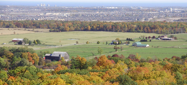
For Simcoe County, including Barrie and Orillia, the proposed density and intensification targets effectively continue the status quo approach to long term growth planning. Simcoe County would be allowed to keep the intensification and density targets that were established under alternative targets given for its 2008 Official Plan. These changes beg the question – what is the vision that the province has for the communities of Simcoe County? Is it a political vision, changing according to the whims of the government of the day, or is it evidence-based planning, utilizing established best-practices done with the best interests of the public in mind? Currently, low density sprawl dominates Simcoe County. Densities around the county range from the 50 ppl/hectare to well below that in some of the more rural communities. We know that densities are needed to support transit and move communities away from car dependency – a development pattern that is costly, inequitable, unhealthy and results in high carbon emissions. The Ministry of Transportation’s own guidelines for building a transit supportive community suggests that to provide basic bus service, a minimum of 50 people per hectare is needed, otherwise the transit service is inefficient and difficult to sustain economically. Even a bus service supported by 50 people per hectare, such as in Barrie, isn’t the kind of transit that is widely available to all residents or allows enough reliability and flexibility to shift transportation patterns away from single vehicle use toward more efficient modes of mass transit.
The proposed “status quo” targets literally cement a development pattern that increases pollution, inequity and municipal debt for the long term. Simcoe County’s population could increase 96% by 2041 from 2011 level. As Hemson Consulting outlined, this could mean that our region could see as many as 900,000 residents by 2041 with Barrie alone growing to 253,000 people. So how we encourage growth in Simcoe County cannot be predicated on how we’ve grown in the past, but rather needs to be based on how we should build communities of the future. We would prefer that the province recognize the growth that Simcoe County will be facing and help support and usher in policies that ensure this growth is not a burden on our future economy.
If the province allows the proposed targets to stand, and allow Simcoe County communities to build mostly as they have for the past few decades, a pattern of growth will proceed that values development of spread out lots with single-detached homes with larger lawns over the preservation of farmland, more expensive road and water infrastructure over ecosystem services, longer commutes and higher fossil fuel emissions over active transportation, increased inequality and poorer health outcomes over a healthy economy. This will negatively impact our economy by reducing our ability to rely on the many benefits provided by clean water, farmland, and green spaces. This effect could be seen clearly over one decade ago as outlined in the Intergovernmental Action Plan (2006):
“Unique growth and development challenges exist in Simcoe County and the Cities of Barrie and Orillia (study area). South Simcoe and Barrie, in particular, are experiencing increased development pressure, and are expected to continue to have rapid growth. A number of the municipalities in the study area rely on inland water systems which have been demonstrated to be under strain (for example the Lake Simcoe watershed has known issues as a result of phosphorous loadings). Without intervening action, the available potable water and aquaculture of these watersheds are threatened.”
This quote has aged well and could easily have been written today instead of over one decade ago. The effects of ill-managed growth continues to wreak havoc on our water systems. The impacts are also seen in our loss of farmland and greenspace. According to Statistics Canada, Barrie’s footprint grew 550% over the past 40 years mostly gobbling up farmland and semi natural space for a total loss of roughly 150 km2. Neptis Foundation determined that from 2006-2012, Simcoe County zoned 13,000 hectares of green space (mostly farmland) to designated greenfield areas – the most in the Greater Golden Horseshoe. This despite the fact that they were experiencing a fraction of growth compared to York, Waterloo and Peel and with an existing oversupply of land for development. Under the current proposals to the Growth Plan, this pattern of low density development will continue. Unbelievably, it is proposed to continue while we know that the province loses hundreds of acres of farmland per day to development; while Lake Simcoe struggles to assimilate urbanization to the detriment of its ecology and dependent industries; while we know that the assimilative capacity of the Nottawasaga River has already been maxed and while Simcoe County already sits on an excess amount of land zoned for development and employment.
Where is the balance in this approach? Where are the limits that ensure that communities are growing sustainably? Where are the aspirational policies that support the economies and communities of the future?
Density and Intensification Recommendations:
● Density targets from the 2017 Growth Plan should be upheld without alternative targets for DGAs.
● Intensification targets should be considered based on current population and future growth potential. For example, Orillia (pop. 31,166) will be held to a higher minimum intensification target than two larger and faster growing communities of Bradford (pop 35, 325) or Innisfil (pop. 33,079). Why?
● Communities that are rural and with low growth projections should also be encouraged to infill their development to provide a range of housing and to best utilize minimal tax revenues. Intensification should not be seen simply as a panacea for city centres. It is important to smaller communities too.
● Remove the opportunity for lower alternative targets. Allow municipalities to exceed targets if they so choose.
● Unless the province wants to ensure car dependency in most of Simcoe County’s larger city centres for the near term, there must be more support and information about the benefits of intensification and density. At the current rate, very few communities in Simcoe County will have the density to feasibly support transit. Provincial planners should be working with communities, both urban and rural, to help them communicate and calculate the benefits of intensification vs. sprawl. This would go a long way to change our damaging development patterns.
Rounding Out and Settlement Area Expansions
Allowing “rounding out” of rural settlement areas and allowing for settlement boundary expansions up to 40 hectares outside of an MCR – even if a municipality has an excess of lands – does not promote efficient use of land, nor does it prioritize intensification, which is a more efficient and equitable way to grow. We would like to know the policy rationale for these suggestions. What is the cumulative impact on our communities, many of which are already financially unsustainable, in almost inescapable infrastructure deficit, low growing or experiencing population loss? How is loosening the proper growth management policies and resulting investments in new infrastructure going to help already struggling communities?
“Rounding Out” Recommendations
● Rounding out should only be considered if infill development within the built boundary and does not require new infrastructure
● Rounding out should provide a full life cycle cost accounting to ensure that the expansion is financially feasible for the community.
● Rounding out should not exceed the population allocations for the municipality for 2041 forecasts
Settlement Area Boundary Expansions
Settlement Area Boundary expansions should not be undertaken lightly. As the footprint of the community grows, the density lowers. As we’ve mentioned earlier, this means that servicing the community becomes more expensive, including transit and infrastructure maintenance and repairs. Moving away from evidence-based planning is not necessary and hurts the long term success of communities.
Settlement Area Boundary Expansion Recommendations
● Expansions should only be considered within an MCR process
● Expansions should not be considered if there is an excess of lands. The municipality should de-designate the excess lands before asking for an expansion.
● The addition of 40 ha to a settlement boundary is reckless and should not be a considered policy. It does not promote evidence based planning. The target seems arbitrary and we question the problem this policy is trying to solve.
● Rural settlement areas should not be considered for settlement boundary expansions as they should not be receiving significant (if any) growth. This includes hamlets and villages in the Greenbelt.
We recognize that there is more than metrics and numbers when building strong communities that meet the needs of citizens. Our goal is not to be anti-development, rather we seek to encourage community development that meets the needs of the community. This should be the primary objective of all levels of government when they look at planning and development.
Other Ideas to Increase Housing Supply and to Create Stronger Communities
● Remove parking minimums for developments. Parking minimums should also not be a mandatory component for infrastructure projects such as hospitals or schools. Parking minimums force more space to be used than necessary and add to the cost of housing.They also severely limit the ability of businesses to expand, and for new business to emerge in urban downtown areas. For infrastructure projects, it requires a large footprint that is generally not found within city centres thereby forcing new hospitals or schools to move to the fringes of a community. This only encourages sprawl and moves services away from people who need it.
● Consider hard urban boundaries for all towns and cities within the Greater Golden Horseshoe. Use existing municipal mapping to determine the boundary.
● Expand the Greenbelt over areas of hydrological and ecological significance. This would ensure that those areas are protected while putting boundaries delineating where growth can and cannot go. This helps achieve balance between the places we can use to grow and the places we need for our current and future health and prosperity.
● Increase data gathering to understand the effectiveness of the Growth Plan. This will allow for implementation and future policy development that is data and evidence driven, ensuring costly mistakes aren’t made and taxpayers realize maximal return. Include data to determine vacancy rates of existing housing, demographics to best prepare for the boomer generation’s exit from the housing market and available land supply that is approved and serviced.
● Consider policies that encourage rental development, co-ops and “missing middle” housing. This could be providing DC deferrals so purpose built housing is incentivized.
● Link new infrastructure funding to where job growth is projected and give priority to those projects that will support transit, prioritizing infrastructure for active transportation to realize the many co-benefits it provides.
● Research the link between different types of development patterns with climate impacts. Consider including carbon emission calculations in development proposals so that the full impact of a development pattern on a community’s long term health can be properly understood.
● Stop building new highways on greenfield within the GGH and reconsider highway expansions. Redirect funds earmarked for inefficient car infrastructure toward transit, active transit, and more efficient commercial transportation infrastructure projects that help keep people and goods moving. New highways or wider highways have been shown to only induce demand, and eventually gridlock returns to previous levels. Reducing car traffic to ensure goods can be quickly moved on our existing highway network is a more prudent approach, particularly in light of the fact that transportation accounts for the largest share of Ontario’s greenhouse gas emissions, and the necessity of reducing these emissions in the most cost effective manner. Shifting from built infrastructure that prioritizes the use of cars and trucks toward communities that prioritize people and the ecosystems we rely on for our health, well being, and economic prosperity, which is in no way conflicting with economic sustainability, is the only way to create a future for Ontario that we can all equally rely on.
We thank you for your time and consideration of this submission. Please feel free to contact us if you have any questions or comments. Please find attached below, the recommendations by the Ontario Greenbelt Alliance which we fully support.
Sincerely, Margaret Prophet On behalf of the Simcoe County Greenbelt Coalition
Ontario Greenbelt Alliance Recommendations
1. Employment area conversions The existing MCR process may in some cases be too onerous and hinder the creation of mixed-use projects (e.g. the redevelopment of lands near the Kitchener ION). Employment uses are changing and work is becoming increasingly mobile. Economic development strategies are essential to understand local needs and employment trends and these strategies should inform any desired conversions. Like all planning matters, conversions should be public and evidence based. Conversions should only occur if the employment lands are in excess of projected needs to 2041. Recommendation: The following conditions should apply to employment land conversions: a) the proposed land designation conversion supports the objectives of the Growth Plan, in particular, the density targets for residents/jobs per ha are attained that support transit, 150 ppj/ha and 200 ppj/ha near subways and 80 ppj/ha for regular 10-15 minute bus service. b) the conversion is to mixed use, multi- storey buildings and prioritizes rental housing. Employment land is not converted to low-density single family housing. c) designated employment land within 500 m of a 400 series highway should be retained for employment uses and agriculture, not converted to housing or institutional uses due to health impacts from traffic pollution. d) conversions are evidence-based, a regional economic development strategy has been completed, the employment land retained by the municipality exceeds the need to 2041.
2. Agricultural and Natural Heritage System Implementation
2.1 Natural Heritage System Implementation
Mapping a natural heritage system provides clarity and reduces duplication between various levels of government. The current piecemeal approach to natural heritage protection is not working. Between 2000 and 2011, we lost 6152 hectares of wetlands in southern Ontario. Wetlands are valuable; they can reduce the financial costs of floods by up to 38 per cent and provide water and nutrient filtration services as well as critical wildlife habitat and recreational opportunities.
Recommendation: We urge the province to use recently completed Ministry of the Natural Resources and Forestry mapping as a baseline and incorporate more refined conservation authority mapping if it is available and can be shown to more accurately characterize the mapped features or functions. Ground truth maps and incorporate local knowledge.
a) Expand the Greenbelt throughout the provincial agricultural areas and natural heritage systems.
b) The province needs to lead on this file including developing a joint comparison/evaluative process with municipal and conservation authority mapping data.
c) Where there is a conflict in mapping the more restrictive mapping should apply or a NHS evaluation should take place.
d) Natural Heritage mapping must be applied consistently across the Greater Golden Horseshoe, including whitebelt lands.
2.2 Agricultural System Implementation
Between 2011 and 2016 Ontario lost 319,700 acres of productive agricultural land (175 acres per day). Not only is this loss unsustainable from a food security perspective but it symptomatic of an unaffordable pattern of urban growth. Allowing boundary expansions of towns and cities paves over productive farmland.
Recommendation:
a) Support the provincial Agricultural System to consistently protect farmland across the Greater Golden Horseshoe. Farming is a business and the agri- food sector is a key economic sector in Ontario.
b) Maintain fixed urban boundaries for existing urban and rural settlement areas throughout the GGH. Create permanent growth boundaries where mapping shows a healthy agricultural system or natural heritage feature.
c) Ensure municipal zoning of prime agricultural land is consistent with Provincial agricultural system mapping.
d) Land swaps of Greenbelt land are not acceptable. The Greenbelt permanently protects land. Opening lands in the Greenbelt for development would signal the end of the Greenbelt Plan to millions of Ontarians.
3. Major Transit Station Areas
Transit and growth should be integrated to support transit that connects urban growth centres. This will relieve congestion for citizens and goods moving throughout the Greater Golden Horseshoe and within urban growth centres. A 2014 Ministry of Health study estimated that 154 premature deaths and health benefits valued at $1 billion per year could be achieved by implementing the Big Move regional transit plan.
Recommendation:
Ensure density and transit are complementary and integrated (subways, 200 pp/ha., light rail transit 160 pp/ha., GO trains 150 pp/ha, 80pj/ha buses 10-15 minutes). Lower densities of 50 pp/ha make regular transit unsustainable.
a) Maintain existing density targets for mobility hubs within urban growth centres.
b) Rezone lands around existing mobility hubs (Metrolinx Plan) to support transit oriented development while reducing congestion (include a mix of more affordable housing including rental, mid-rise and low- rise).
c) Existing policies already have flexibility i.e. Municipalities can shift density along transit corridor with existing policies.
d) Avoid using transit to direct growth to greenfield areas or the edge of settlement areas. Instead use transit to revitalize downtowns and support complete communities.
4. Settlement Boundary Expansions
Data produced to date indicates that there is more than enough land already allocated to accommodate expected population growth in the Greater Golden Horseshoe within existing urban boundaries to 2031. In some regions there is an excess of land, for example, York Region has a 23 year supply of land for housing and an excess supply of employment land. If we build more missing middle housing we can reduce land consumption. For example, a recent study by Ryerson City Building Institute indicates that Mississauga can accommodate 174,000 mid-rise housing units within its existing urban footprint, 85% of Peel Region’s allocated growth. Missing middle family housing provides affordable housing where urban services exist reducing municipal costs and retaining precious farmland. If urban boundary expansions proceed when there is excess land then land use is not maximized resulting in inefficiencies, such as lost revenue for municipalities from vacant land and costs for infrastructure expansions resulting in higher taxes.
Recommendation:
a) Clarity is required to understand 1) who can make a request for a boundary expansion and 2) the number of boundary expansions that can be requested outside of an MCR process.
b) Hold the line on urban boundary expansions to support intensification to prevent sprawl, farmland loss and maximize the efficiency of existing infrastructure.
c) Keep the MCR process, essential for evidence-based planning.
d) No rounding out to rural settlement boundaries or the boundaries of towns and villages or hamlets in the Greenbelt Plan.
e) Do not proceed with allowing settlement boundary expansions of up to 40 hectares (the size of Yorkdale) or multiple expansions.
5. Density and Intensification Targets
There is an excess of land for housing in many communities due to the use of the 2006 Growth Plan market-based land assessment during MCR preparation. During the 2017 Growth Plan review there was consensus reached among the multi-sector stakeholder panel to move to a target of 80 pj/ha. At the time industry concerns about the stock of single-family homes was found to be unsubstantiated as municipalities had planned for 800,000 ground related housing units providing for 80% of the expected population growth. Changes were made to calculating density targets by excluding employment areas, freeways, railways, pipelines, hydrolines, and cemeteries. Those exemptions and the new lower targets proposed further reduce densities in some areas below 2006 levels to 1990 densities. (See Appendix 2, Envisioning Brant County study).
Housing trends and demographic shifts indicate a broader mix of housing is needed beyond tall condos and low density housing. A report by Ryerson’s City Building Institute indicates that most of our housing needs can be met through mid-rise (4-10 stories) missing middle development. And transit supportive densities reduce congestion estimated by the Toronto Board of Trade to be costing our economy up to $15 billion per year by 2031. Beyond economic costs, increased traffic congestion has many implications for commuters including health costs and a loss of family time. A recent study by CMHC indicates a longer commute also reduces the affordability advantage provided by lower housing costs on the edge of the GGH.
Density makes housing, schools, road and servicing infrastructure more affordable and sets the land-use stage for providing the diversity of housing that people want. In the Greater Toronto Area 81% of respondents to a home-buyers survey prefer a smaller house or condo in a walkable transit friendly neighbourhood over a large house and a long commute.
Regional and County governments can and do account for variations and infrastructure capability of lower tiers when allocating growth. Also 75% of the forecasted growth is in greenfield areas that are contiguous to urban areas and most areas are supported by the regional transportation plan. Allowing all municipalities to lower growth targets is contrary to the principals of compact transit supportive growth in the Growth Plan and will make it difficult to ever be able to provide appropriate levels of transit to low density areas in both the inner and outer ring.
Recommendations:
a) Keep the 2017 Growth Plan density and intensification targets and make them mandatory, there is already flexibility with expansion criteria through MCR process. Hold the line on density targets to develop the type of housing supply needed.
b) Clarity and transparency is needed to improve monitoring and reporting on implementation to better understand problems and find the best solution.
c) Update growth projections based on the census and Ministry of Finance projections.
6. Recommendations to reduce red tape:
a) Address housing affordability by getting rid of the right red tape (Section 37). Section 37 is a negotiation process that takes time and resources away from planning, reduces transparency in the planning process and inspires NIMBY’s.
b) Reduce duplication by enacting data sharing agreements between the Province, Municipalities and Conservation Authorities.
7. Other recommendations:
a) Raise the profile of Indigenous interests, treaty rights, consultation, and planning approaches and priorities.
b) Increase support for land securement as a tool for growth management and natural/agricultural/cultural heritage protection, including enabling severances/land subdivision for conservation purposes and associated incentives.
c) Retain a long-term sustainable approach to growth management that focuses on more than the number of houses built but the vibrancy and resiliency of our communities.
Leave a Reply